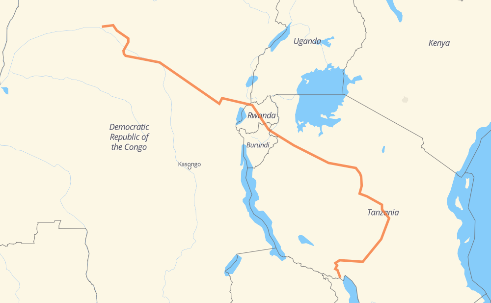
The distance from Monongo to Kasumulu is 1,903 miles by road. Road takes approximately 39 hours and 18 minutes and goes through Lubutu, Gisenyi, Musanze, Dodoma and Iringa.
You can adjust fuel consumption and fuel price here.
How long is a car ride from Monongo to Kasumulu?
Driving time:
39 h 18 min
This time is calculated for driving at the maximum permitted speed, taking into account traffic rules restrictions.
505 mi with a maximum speed 56 mph = 9 h
1,276 mi with a maximum speed 50 mph = 25 h 39 min
116 mi with a maximum speed 31 mph = 3 h 44 min
2 mi with a maximum speed 25 mph = 5 min
10 mi with a maximum speed 12 mph = 47 min
The calculated driving time does not take into account intermediate stops and traffic jams.
How far is Monongo to Kasumulu by land?
The distance between Monongo and Kasumulu is 1,902.6 mi by road.
Precise satellite coordinates of highways were used for this calculation. The start and finish points are the centers of Monongo and Kasumulu respectively.
How far is Monongo to Kasumulu by plane?
The shortest distance (air line, as the crow flies) between Monongo and Kasumulu is 1,122.8 mi.
This distance is calculated using the Haversine formula as a great-circle distance between two points on the surface of a sphere. The start and finish points are the centers of Monongo and Kasumulu respectively. Actual distance between airports may be different.
How many hours is Monongo from Kasumulu by plane?
Boeing 737 airliner needs 2 h 15 min to cover the distance of 1,123 mi at a cruising speed of 497 mph.
Small plane "Cessna 172" needs 8 h 12 min to flight this distance at average speed of 136 mph.
This time is approximate and do not take into account takeoff and landing times, airport location and other real world factors.
How long is a helicopter ride from Monongo to Kasumulu?
Fast helicopter "Eurocopter AS350" or "Hughes OH-6 Cayuse" need 7 h 31 min to cover the distance of 1,123 mi at a cruising speed of 149 mph.
Popular "Robinson R44" needs 8 h 36 min to flight this distance at average speed of 130 mph.
This time is approximate and do not take into account takeoff and landing times, aerodrome location and other real world factors.
What city is halfway between Monongo and Kasumulu?
The halfway point between Monongo and Kasumulu is Ngara. It is located about 5 mi from the exact midpoint by road.
The distance from Ngara to Monongo is 946 mi and driving will take about 19 h 29 min. The road between Ngara and Kasumulu has length 956 mi and will take approximately 19 h 49 min.
The other cities located close to halfway point:
Kasulo is in 964 mi from Monongo and 938 mi from Kasumulu
Nyabugombe is in 976 mi from Monongo and 926 mi from Kasumulu
Butihinda is in 923 mi from Monongo and 979 mi from Kasumulu
Where is Monongo in relation to Kasumulu?
Monongo is located 1,123 mi north-west of Kasumulu.
Monongo has geographic coordinates: latitude 2.19863, longitude 22.54719.
Kasumulu has geographic coordinates: latitude -9.58212, longitude 33.7796.
Which highway goes from Monongo to Kasumulu?
The route from Monongo to Kasumulu follows T3, RN3, T1, T5, RP529, RP405, NR2, RP408, T10, RP401.