Distance between Makoko and Kachere
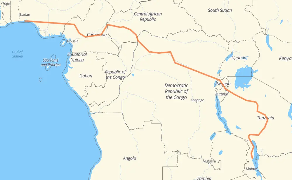
The distance from Makoko to Kachere is 4,071 miles by road including 40 miles on motorways. Road takes approximately 82 hours and 55 minutes and goes through Victoria Island, Sagamu, Ijebu-Ode, Benin-Stadt, Onitsha, Bamenda and Bafoussam.
| Shortest distance by air | 2,458 mi ✈️ |
| Car route length | 4,071.2 mi 🚗 |
| Driving time | 82 h 55 min |
| Fuel amount | 138.5 gal |
| Fuel cost | 544.2 USD |
| Point | Distance | Time | Fuel | |
| Makoko | 0 mi | 00 min | 0.0 gal | |
|
3 mi, 04 min
|
||||
| Victoria Island | 3 mi | 04 min | 0.1 gal | |
|
F265 E1 53 mi, 59 min
|
||||
| Sagamu | 56 mi | 1 h 04 min | 1.6 gal | |
|
A121-1 234 mi, 4 h 38 min
|
||||
| Onitsha | 290 mi | 5 h 43 min | 9.8 gal | |
|
A232 N6 309 mi, 6 h 19 min
|
||||
| Bamenda | 599 mi | 12 h 02 min | 20.4 gal | |
|
N6 48 mi, 57 min
|
||||
| Bafoussam | 647 mi | 12 h 59 min | 22.0 gal | |
|
N6 N4 102 mi, 2 h 02 min
|
||||
| Bafia | 749 mi | 15 h 02 min | 25.2 gal | |
|
N4 N 1 240 mi, 4 h 53 min
|
||||
| Bertoua | 989 mi | 19 h 55 min | 33.6 gal | |
|
N1 286 mi, 5 h 43 min
|
||||
| Baoro | 1,275 mi | 25 h 39 min | 43.2 gal | |
|
RN 3 229 mi, 4 h 34 min
|
||||
| Bangui | 1,504 mi | 30 h 13 min | 51.0 gal | |
|
RN 2 RN6 168 mi, 3 h 22 min
|
||||
| Gemena | 1,672 mi | 33 h 36 min | 56.5 gal | |
|
RN6 745 mi, 15 h 38 min
|
||||
| Lubutu | 2,417 mi | 49 h 14 min | 81.7 gal | |
|
RN3 RP529 267 mi, 5 h 18 min
|
||||
| Gisenyi | 2,684 mi | 54 h 33 min | 91.1 gal | |
|
NR2 29 mi, 34 min
|
||||
| Musanze | 2,713 mi | 55 h 08 min | 92.0 gal | |
|
NR2 T3 701 mi, 13 h 56 min
|
||||
| Dodoma | 3,414 mi | 69 h 04 min | 115.8 gal | |
|
T3 T5 192 mi, 4 h 14 min
|
||||
| Iringa | 3,606 mi | 73 h 19 min | 121.4 gal | |
|
T1 M1 411 mi, 8 h 24 min
|
||||
| Mzuzu | 4,017 mi | 81 h 44 min | 136.3 gal | |
|
M5 60 mi, 1 h 10 min
|
||||
| Kachere | 4,077 mi | 82 h 55 min | 138.6 gal | |
Hotels of Kachere
Frequently Asked Questions
How much does it cost to drive from Makoko to Kachere?
Fuel cost: 544.2 USD
This fuel cost is calculated as: (Route length 4,071.2 mi) / (Fuel consumption 29.4 mpg) * (Fuel price 3.93 USD / gal)
You can adjust fuel consumption and fuel price here.
How long is a car ride from Makoko to Kachere?
Driving time: 82 h 55 min
This time is calculated for driving at the maximum permitted speed, taking into account traffic rules restrictions.
- 17 mi with a maximum speed 62 mph = 16 min
- 748 mi with a maximum speed 56 mph = 13 h 20 min
- 3,127 mi with a maximum speed 50 mph = 62 h 53 min
- 19 mi with a maximum speed 43 mph = 26 min
- 153 mi with a maximum speed 31 mph = 4 h 56 min
- 2 mi with a maximum speed 25 mph = 5 min
- 12 mi with a maximum speed 12 mph = 55 min
The calculated driving time does not take into account intermediate stops and traffic jams.
How far is Makoko to Kachere by land?
The distance between Makoko and Kachere is 4,071.2 mi by road including 40.4 mi on motorways.
Precise satellite coordinates of highways were used for this calculation. The start and finish points are the centers of Makoko and Kachere respectively.
How far is Makoko to Kachere by plane?
The shortest distance (air line, as the crow flies) between Makoko and Kachere is 2,458.1 mi.
This distance is calculated using the Haversine formula as a great-circle distance between two points on the surface of a sphere. The start and finish points are the centers of Makoko and Kachere respectively. Actual distance between airports may be different.
How many hours is Makoko from Kachere by plane?
Boeing 737 airliner needs 4 h 56 min to cover the distance of 2,458 mi at a cruising speed of 497 mph.
Small plane "Cessna 172" needs 17 h 58 min to flight this distance at average speed of 136 mph.
This time is approximate and do not take into account takeoff and landing times, airport location and other real world factors.
How long is a helicopter ride from Makoko to Kachere?
Fast helicopter "Eurocopter AS350" or "Hughes OH-6 Cayuse" need 16 h 29 min to cover the distance of 2,458 mi at a cruising speed of 149 mph.
Popular "Robinson R44" needs 18 h 50 min to flight this distance at average speed of 130 mph.
This time is approximate and do not take into account takeoff and landing times, aerodrome location and other real world factors.
What city is halfway between Makoko and Kachere?
The halfway point between Makoko and Kachere is Yakapko. It is located about 21 mi from the exact midpoint by road.
The distance from Yakapko to Makoko is 2,014 mi and driving will take about 41 h 1 min. The road between Yakapko and Kachere has length 2,057 mi and will take approximately 41 h 53 min.
The other cities located close to halfway point:
Where is Makoko in relation to Kachere?
Makoko is located 2,458 mi north-west of Kachere.
Makoko has geographic coordinates: latitude 6.42888, longitude 3.45514.
Kachere has geographic coordinates: latitude -12.00389, longitude 34.04899.
Which highway goes from Makoko to Kachere?
The route from Makoko to Kachere follows T3, RN6, RN3, RN 3, T1, N6, N1, M1, T5, N 1, A121-1, RP529, N4, RP405, NR2, RN 1, RP408, A232, M5, T10, RP401.
Other minor sections pass along the road:
- RN23: 58 mi
- A4: 58 mi
- T11: 37 mi
- NR5: 37 mi
- E1: 28 mi
- RS340: 26 mi
- T8: 24 mi
- RP 61: 20 mi
- P 13: 17 mi
- RN2: 16 mi
- RN4: 14 mi
- D 48a: 11 mi
- RN 2: 7 mi
- D48A: 7 mi
- F265: 7 mi
- N 4: 6 mi
- A6: 4 mi
- RN 14: 3 mi
- NR1: 2 mi
- A3: 2 mi
- A3-1: 2 mi
- N15: 1 mi
- F264: 1 mi
- RP61: 1 mi
- RP 63: 1 mi