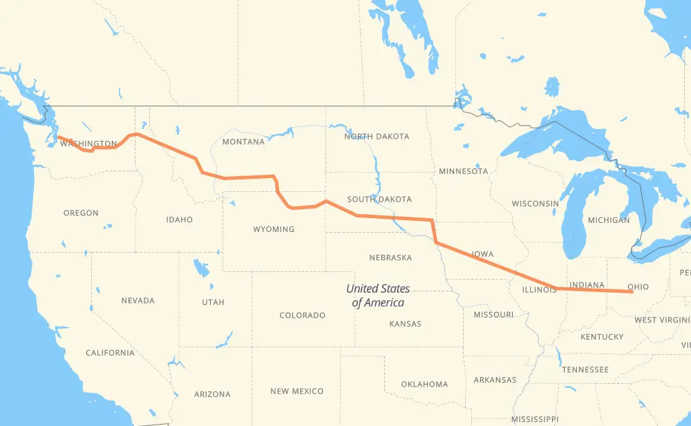
Distance between Columbus OH and Seattle WA
The distance from Columbus to Seattle is 2,436 miles by road including 2,300 miles on motorways. Road takes approximately 36 hours and 58 minutes and goes through Indianapolis, Bloomington, Peoria, Davenport, Iowa City, Cedar Rapids and Waterloo.
| Shortest distance by air | 2,009 mi ✈️ |
| Car route length | 2,435.8 mi 🚗 |
| Driving time | 36 h 58 min |
| Fuel amount | 82.8 gal |
| Fuel cost | 325.6 USD |
| Point | Distance | Time | Fuel | |
| Columbus | 0 mi | 00 min | 0.0 gal | |
|
US 33 I 70 173 mi, 2 h 37 min
|
||||
| Indianapolis | 173 mi | 2 h 37 min | 5.9 gal | |
|
I 65 I 74 168 mi, 2 h 31 min
|
||||
| Bloomington | 342 mi | 5 h 08 min | 11.5 gal | |
|
US 51 I 74 42 mi, 38 min
|
||||
| Peoria | 384 mi | 5 h 46 min | 12.9 gal | |
|
I 74 98 mi, 1 h 27 min
|
||||
| Davenport | 482 mi | 7 h 14 min | 16.2 gal | |
|
I 80 50 mi, 44 min
|
||||
| Iowa City | 531 mi | 7 h 58 min | 18.0 gal | |
|
I 80 US 218 25 mi, 23 min
|
||||
| Cedar Rapids | 557 mi | 8 h 22 min | 18.6 gal | |
|
I 380 55 mi, 50 min
|
||||
| Waterloo | 612 mi | 9 h 12 min | 20.7 gal | |
|
IA 27 US 20 209 mi, 3 h 32 min
|
||||
| Sioux City | 821 mi | 12 h 44 min | 27.8 gal | |
|
I 29 84 mi, 1 h 15 min
|
||||
| Sioux Falls | 905 mi | 14 h 00 min | 30.6 gal | |
|
I 29 I 90 75 mi, 1 h 06 min
|
||||
| Mitchell | 981 mi | 15 h 07 min | 33.0 gal | |
|
I 90 255 mi, 3 h 45 min
|
||||
| Box Elder | 1,236 mi | 18 h 53 min | 41.8 gal | |
|
I 90 12 mi, 10 min
|
||||
| Rapid City | 1,248 mi | 19 h 03 min | 42.3 gal | |
|
I 90 42 mi, 37 min
|
||||
| Spearfish | 1,289 mi | 19 h 40 min | 43.6 gal | |
|
I 90 97 mi, 1 h 29 min
|
||||
| Gillette | 1,386 mi | 21 h 10 min | 47.0 gal | |
|
I 90 99 mi, 1 h 34 min
|
||||
| Sheridan | 1,486 mi | 22 h 45 min | 50.3 gal | |
|
I 90 134 mi, 2 h 03 min
|
||||
| Billings | 1,620 mi | 24 h 48 min | 54.9 gal | |
|
I 90 226 mi, 3 h 20 min
|
||||
| Butte | 1,846 mi | 28 h 09 min | 62.3 gal | |
|
I 90 115 mi, 1 h 41 min
|
||||
| Missoula | 1,960 mi | 29 h 50 min | 66.6 gal | |
|
I 90 165 mi, 2 h 28 min
|
||||
| Coeur d'Alene | 2,125 mi | 32 h 18 min | 72.2 gal | |
|
I 90 34 mi, 31 min
|
||||
| Spokane | 2,159 mi | 32 h 50 min | 73.3 gal | |
|
I 90 111 mi, 1 h 38 min
|
||||
| Moses Lake | 2,270 mi | 34 h 28 min | 76.7 gal | |
|
I 90 155 mi, 2 h 19 min
|
||||
| Bellevue | 2,426 mi | 36 h 48 min | 82.4 gal | |
|
I 90 9 mi, 10 min
|
||||
| Seattle | 2,436 mi | 36 h 58 min | 82.7 gal | |
Hotels of Seattle
Frequently Asked Questions
How much does it cost to drive from Columbus to Seattle?
Fuel cost: 325.6 USD
This fuel cost is calculated as: (Route length 2,435.8 mi) / (Fuel consumption 29.4 mpg) * (Fuel price 3.93 USD / gal)
You can adjust fuel consumption and fuel price here.
How long is a car ride from Columbus to Seattle?
Driving time: 36 h 58 min
This time is calculated for driving at the maximum permitted speed, taking into account traffic rules restrictions.
- 1,814 mi with a maximum speed 68 mph = 26 h 40 min
- 275 mi with a maximum speed 65 mph = 4 h 13 min
- 107 mi with a maximum speed 62 mph = 1 h 44 min
- 49 mi with a maximum speed 60 mph = 48 min
- 117 mi with a maximum speed 56 mph = 2 h 6 min
- 29 mi with a maximum speed 55 mph = 31 min
- 3 mi with a maximum speed 50 mph = 3 min
- 34 mi with a maximum speed 50 mph = 41 min
- 4 mi with a maximum speed 45 mph = 4 min
- 1 mi with a maximum speed 35 mph = 1 min
The calculated driving time does not take into account intermediate stops and traffic jams.
How far is Columbus to Seattle by land?
The distance between Columbus and Seattle is 2,435.8 mi by road including 2,299.7 mi on motorways.
Precise satellite coordinates of highways were used for this calculation. The start and finish points are the centers of Columbus and Seattle respectively.
How far is Columbus to Seattle by plane?
The shortest distance (air line, as the crow flies) between Columbus and Seattle is 2,008.9 mi.
This distance is calculated using the Haversine formula as a great-circle distance between two points on the surface of a sphere. The start and finish points are the centers of Columbus and Seattle respectively. Actual distance between airports may be different.
How many hours is Columbus from Seattle by plane?
Boeing 737 airliner needs 4 h 2 min to cover the distance of 2,009 mi at a cruising speed of 497 mph.
Small plane "Cessna 172" needs 14 h 41 min to flight this distance at average speed of 136 mph.
This time is approximate and do not take into account takeoff and landing times, airport location and other real world factors.
How long is a helicopter ride from Columbus to Seattle?
Fast helicopter "Eurocopter AS350" or "Hughes OH-6 Cayuse" need 13 h 28 min to cover the distance of 2,009 mi at a cruising speed of 149 mph.
Popular "Robinson R44" needs 15 h 23 min to flight this distance at average speed of 130 mph.
This time is approximate and do not take into account takeoff and landing times, aerodrome location and other real world factors.
What city is halfway between Columbus and Seattle?
The halfway point between Columbus and Seattle is Wasta. It is located about 11 mi from the exact midpoint by road.
The distance from Wasta to Columbus is 1,207 mi and driving will take about 18 h 26 min. The road between Wasta and Seattle has length 1,228 mi and will take approximately 18 h 32 min.
The other cities located close to halfway point:
Where is Columbus in relation to Seattle?
Columbus is located 2,009 mi east of Seattle.
Columbus has geographic coordinates: latitude 39.96226, longitude -83.00071.
Seattle has geographic coordinates: latitude 47.60383, longitude -122.33006.
Which highway goes from Columbus to Seattle?
The route from Columbus to Seattle follows I 90, I 74, US 20, US 14, I 70, US 87, I 29, IA 27, I 80, US 212, I 380, US 12.
Other minor sections pass along the road:
- US 395: 59 mi
- US 191: 57 mi
- IL 110: 38 mi
- SD 79: 31 mi
- US 16: 25 mi
- US 83: 19 mi
- US 6: 18 mi
- US 218: 16 mi
- MT 200: 14 mi
- US 71: 10 mi
- US 35: 8 mi
- US 51: 7 mi
- I 15: 7 mi
- US 85: 7 mi
- US 89: 7 mi
- SD 63: 7 mi
- SD 73: 6 mi
- SD 50: 6 mi
- SD 34: 6 mi
- I 55: 6 mi
- SR 4: 6 mi
- US 93: 5 mi
- US 61: 4 mi
- SD 45: 4 mi
- US 20 Business: 4 mi
- US 16 Truck: 4 mi
- US 97: 4 mi
- US 2: 2 mi
- US 18: 2 mi
- I 670: 2 mi
- US 59: 1 mi
- US 33: 1 mi
- SR 49: 1 mi
- SD 37: 1 mi
- I 65: 1 mi